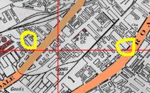
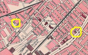
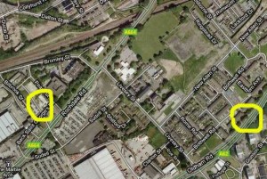
[Maps from http://www.artus-fh.co.uk/Manchester%201935/1b%201935.html]
[Click the maps for a bigger image]
Pilling Street (left mark) is clearly today’s Peary St. Then St.Casimir’s Chapel, later the Club, was next to Stephens and Biesty Garage. Today, that is occupied by the rear of Collyhurst Police Station.
The location of St.Casimir’s Church was on the corner of Oldham Road and Reather Street, which has gone completely.
The priest, Rev. Aloysius Foltin, lived at 1 Reather Street at the Oldham Road end, behind the church.


